Tyger Valley

URBANISATION STRATEGY FOR TYGER VALLEY SHOPPING CENTRE
Spatial Redevelopment Strategy
ABOUT:
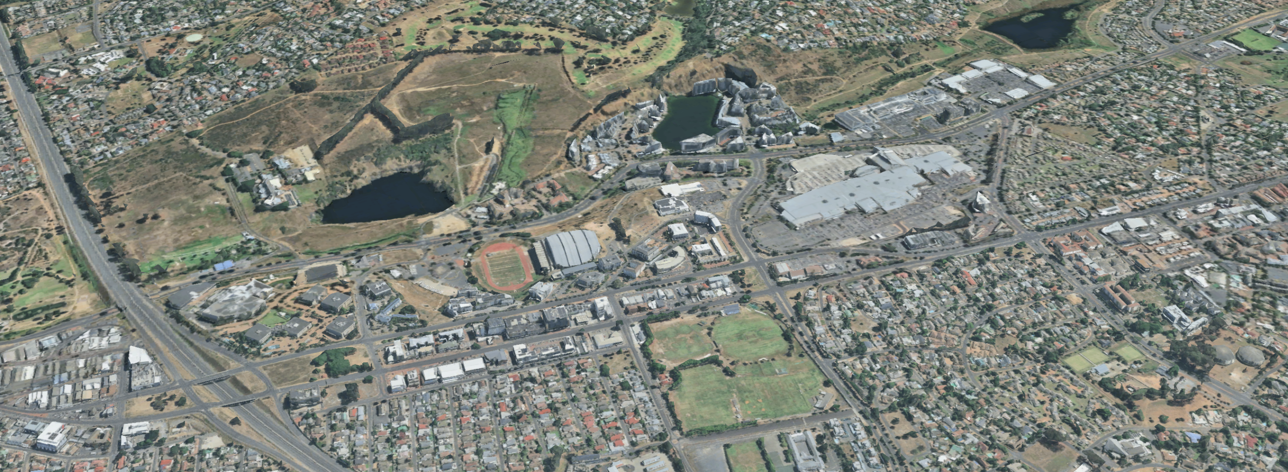
A phased urban redevelopment framework that repositions an inward-facing regional shopping mall as the spatial and civic anchor of a walkable town centre. The strategy focuses on transforming surface parking and vehicular barriers into dense, mixed-use urban fabric, reconnecting the mall to surrounding streets, neighbourhoods, and everyday pedestrian life.
DESCRIPTION:
A phased, adaptable strategy for re-utilising expansive surface parking areas as developable urban land, enabling long-term densification without displacing the existing mall.
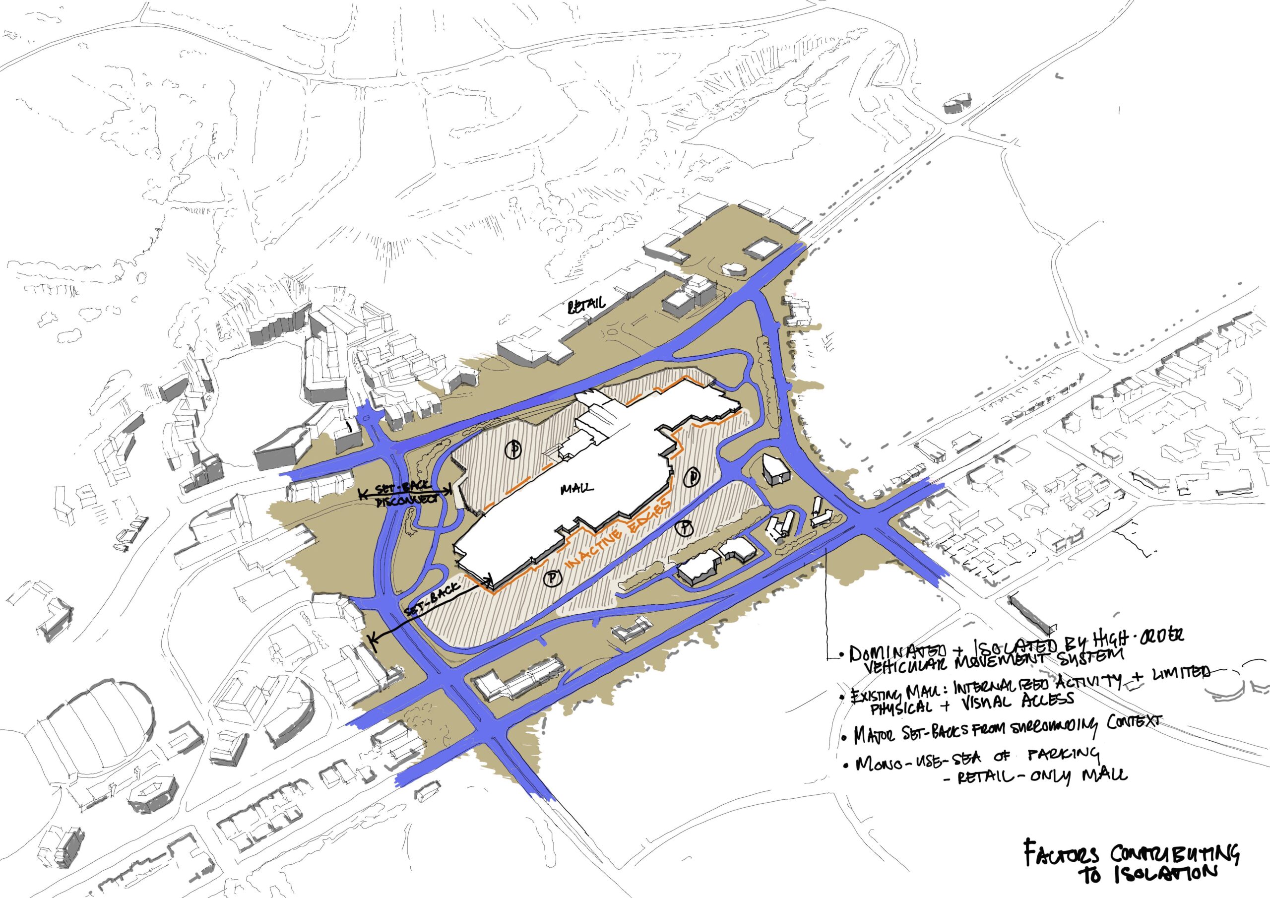
Re-orients the shopping centre from an enclosed, car-dependent island into an outward-facing, street-based urban structure integrated with its surrounding context.
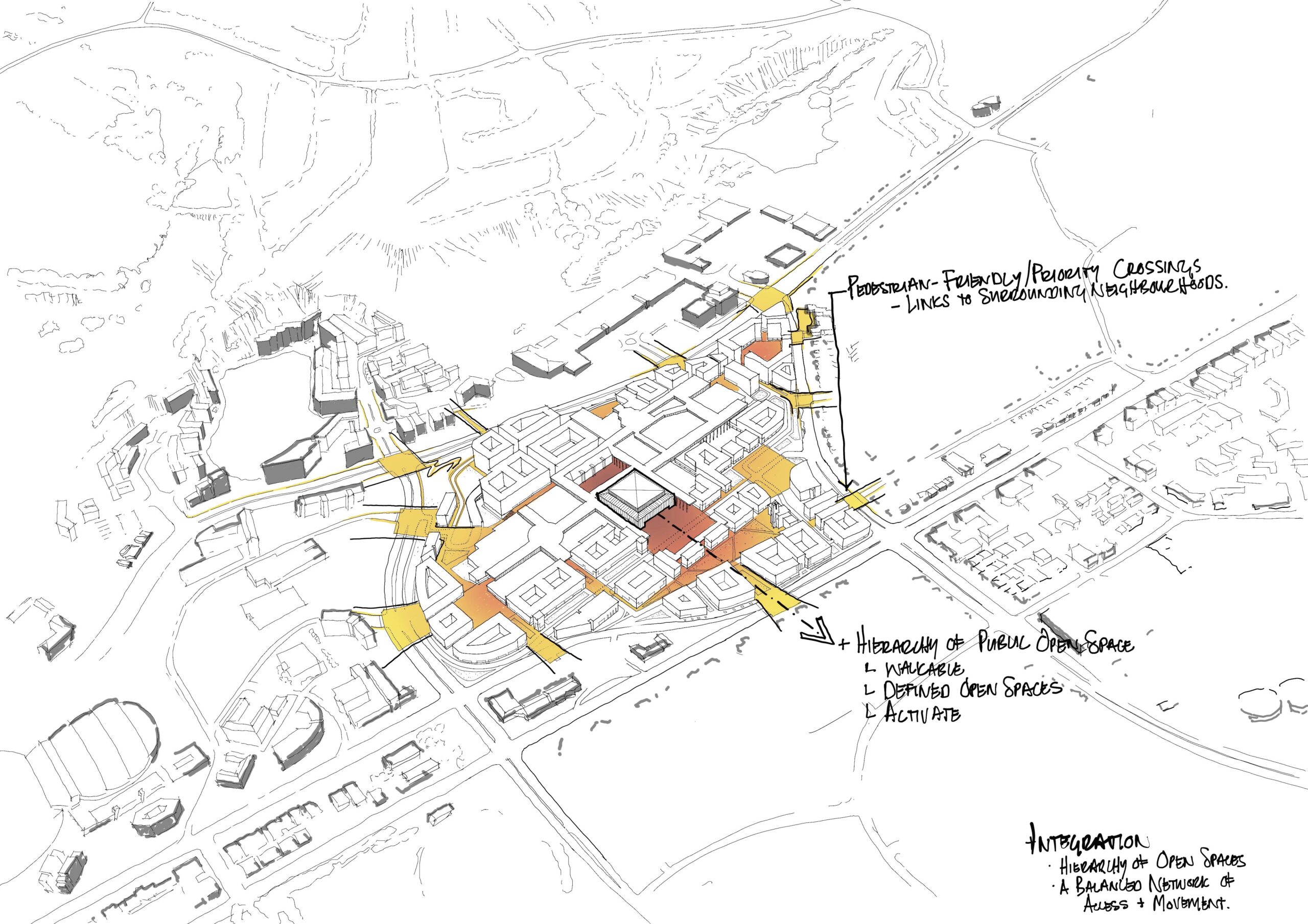
Introduces a fine-grained public street and open-space network across former parking lots, stitching together fragmented neighbourhoods and improving pedestrian permeability.
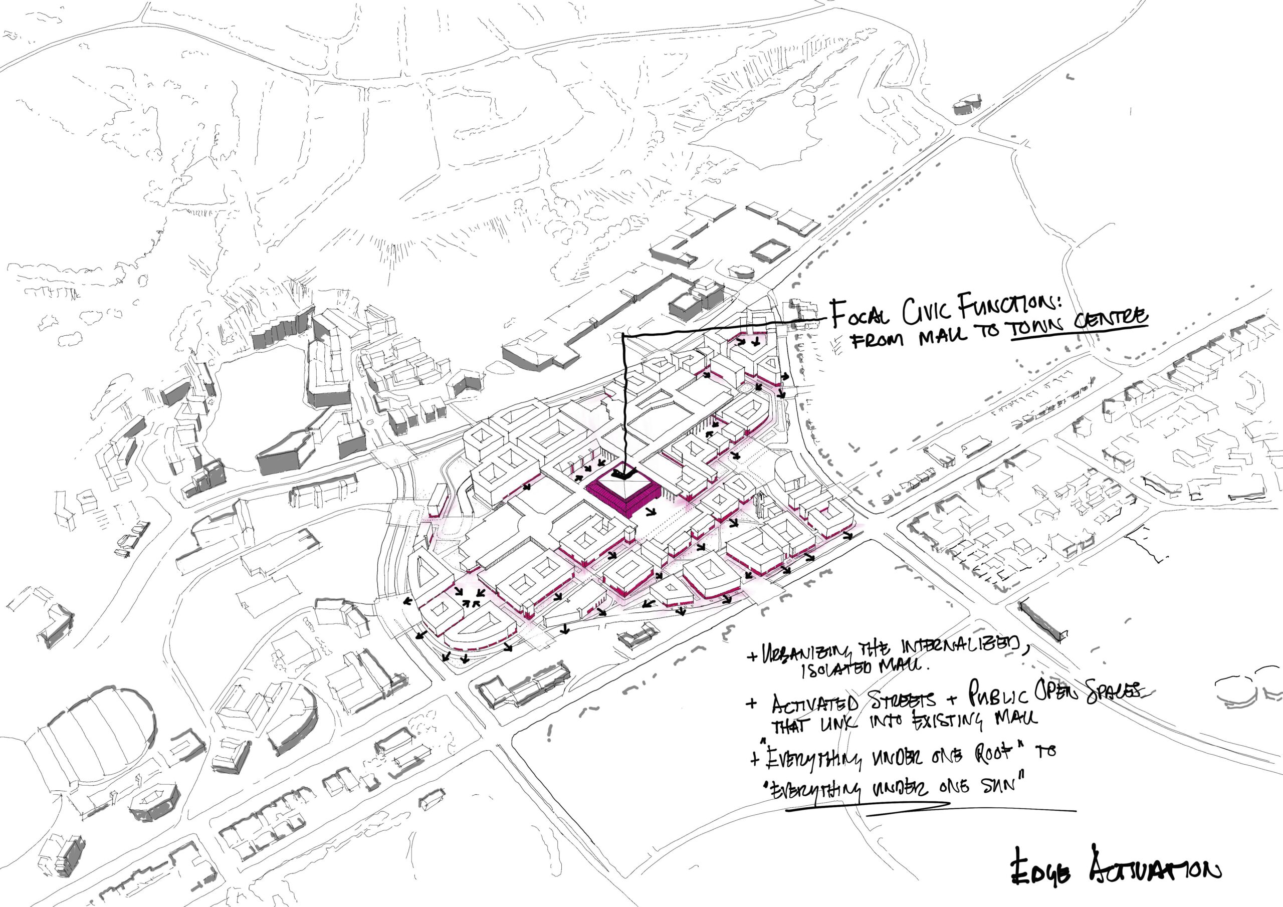
Shifts the mall’s role from a mono-functional retail destination to a mixed-use town-centre core supporting daily life, work, housing, and civic activity.
Addresses the legacy of modernist, car-oriented suburban planning by prioritising walkability, active edges, and human-scaled public space.
Establishes a hierarchy of streets, squares, and activity nodes that support street life, informal interaction, and a strong sense of place.
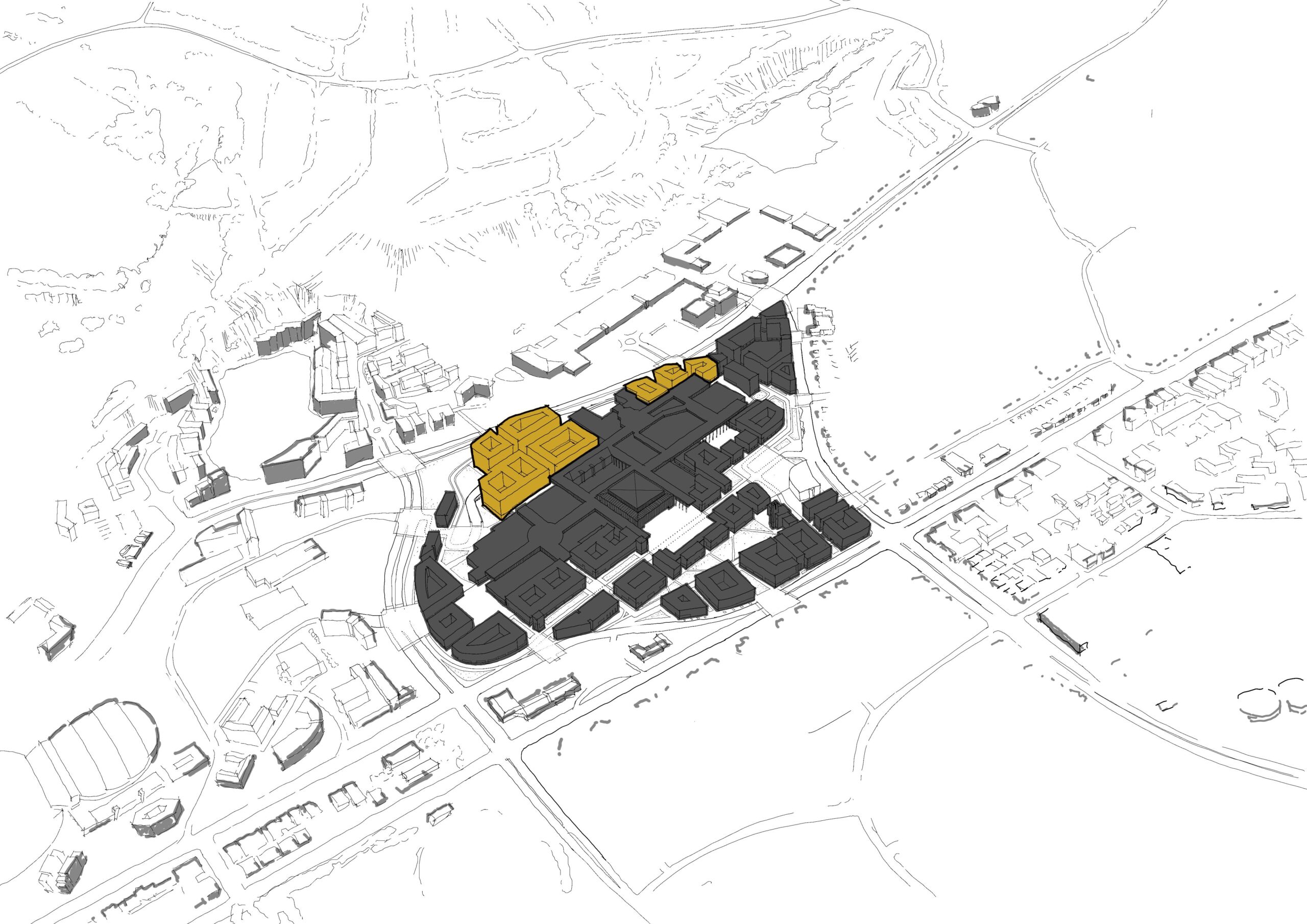
Enables incremental development and investment through clearly defined development parcels and spatial phases.
Detailed elements of the study include:
Status quo analysis of land use, access, movement patterns, and barriers within the broader Tyger Valley catchment.
Identification of key spatial constraints and opportunities created by existing infrastructure, parking typologies, and building footprints.
Conceptual development drivers and spatial principles supporting sustainable, walkable, mixed-use urban growth.
Phased access, movement, and street network strategies for both pedestrian and vehicular integration.
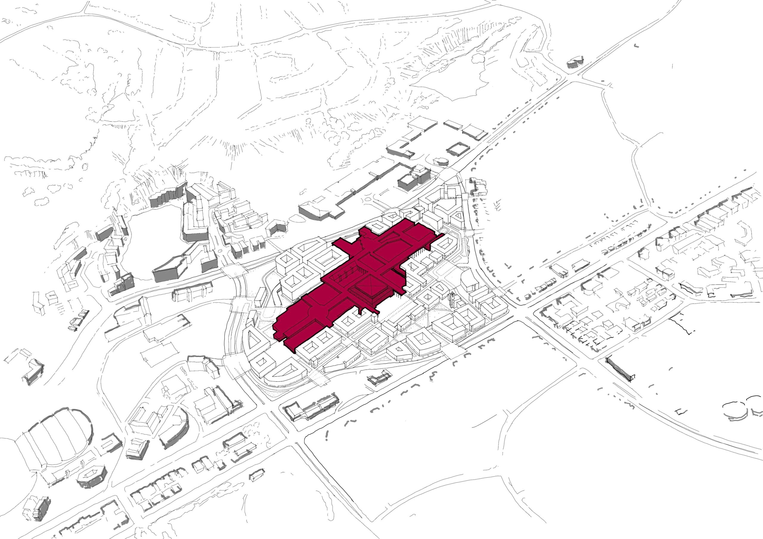
Mapping of developable land areas within existing parking fields and under-utilised edges.
Bulk, height, and density studies testing achievable urban intensification scenarios over time.
Proposed land-use mix supporting retail, commercial, residential, civic, and public open-space functions.
Activation strategies for edges, thresholds, and public interfaces between old and new built form.